
ZL190 Handheld GPS for Surveying, High Precision GPS Surveying Equipment for Mountainous Land Slope and Flat Field Outdoor Use
Original price was: €139.99.€103.99Current price is: €103.99.
34 in stock
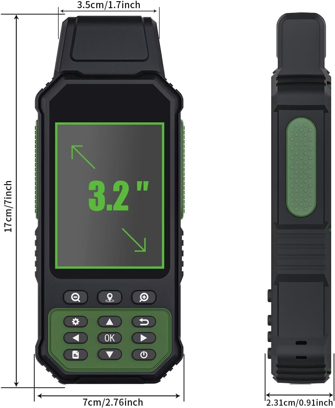
**ZL190 Handheld GPS for Surveying**
—
**Product Overview:**
Enhance your surveying precision with the ZL190 Handheld GPS, a cutting-edge solution designed for professionals who demand accuracy and reliability in diverse terrains. Whether you’re working on mountainous land slopes or flat fields, this high-precision GPS surveying equipment ensures optimal performance in all outdoor environments.
**Key Features:**
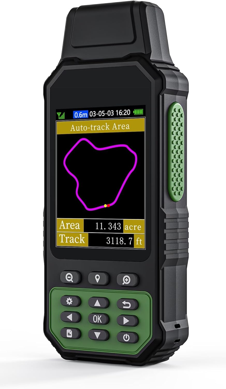
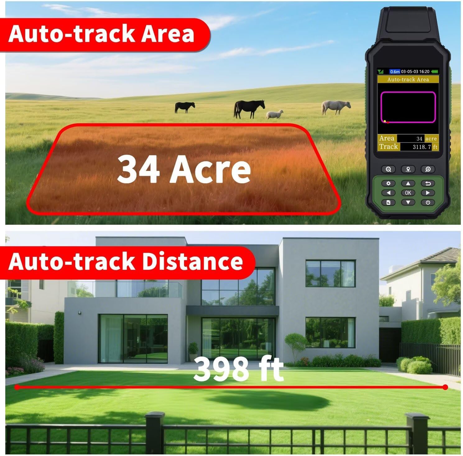
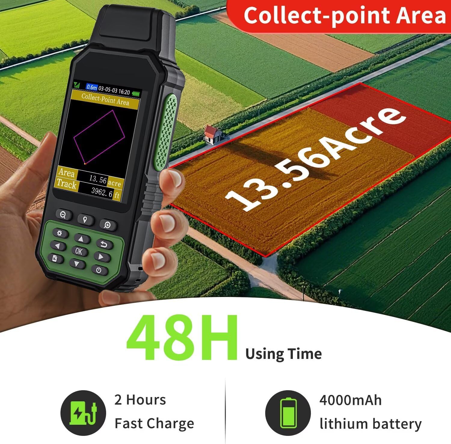
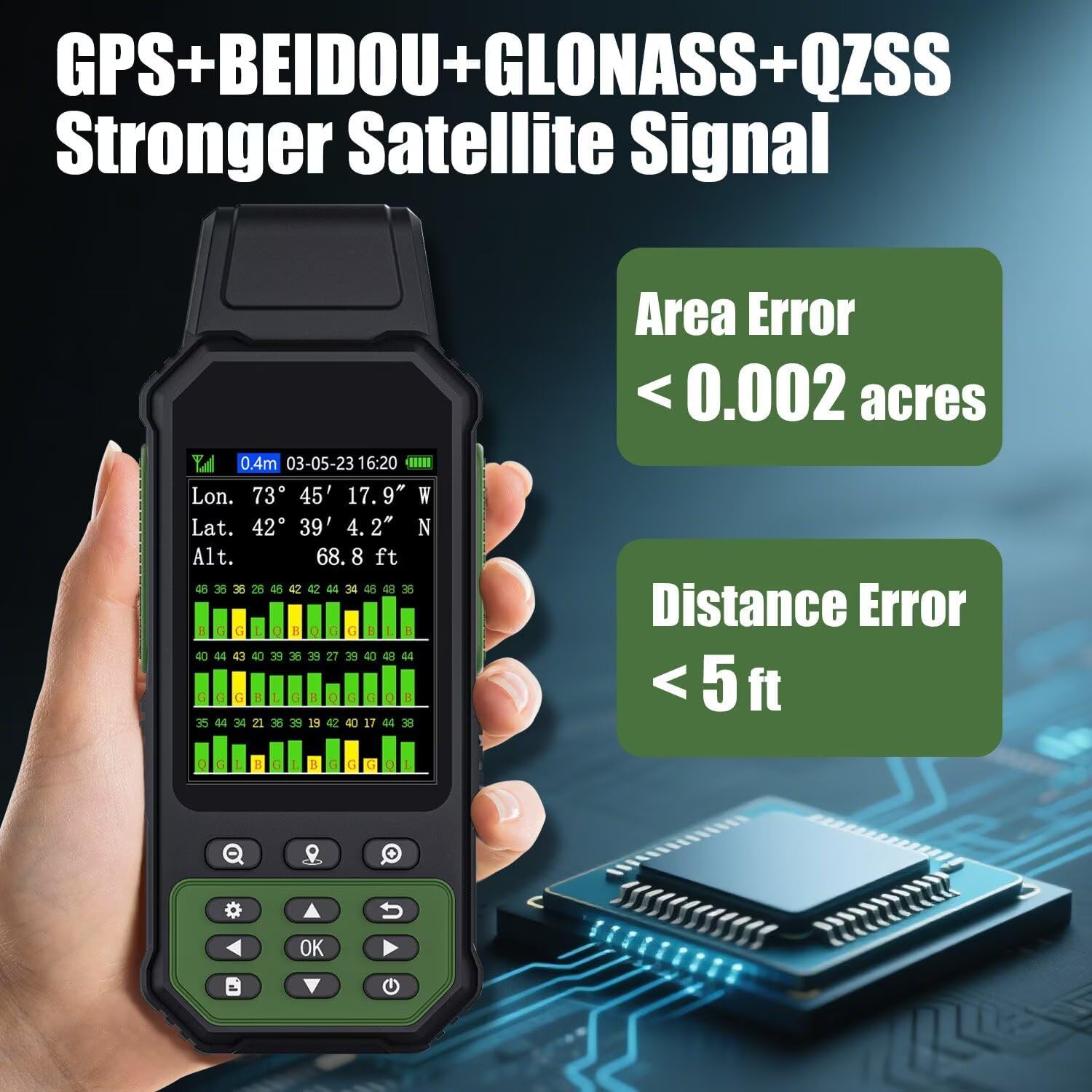
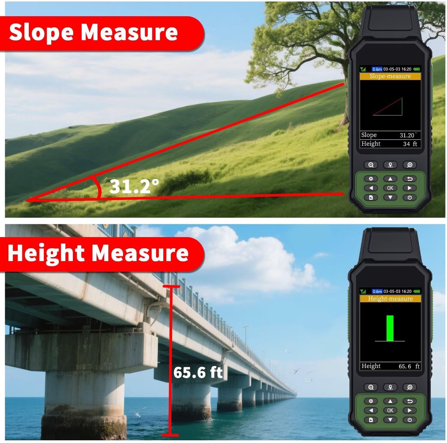
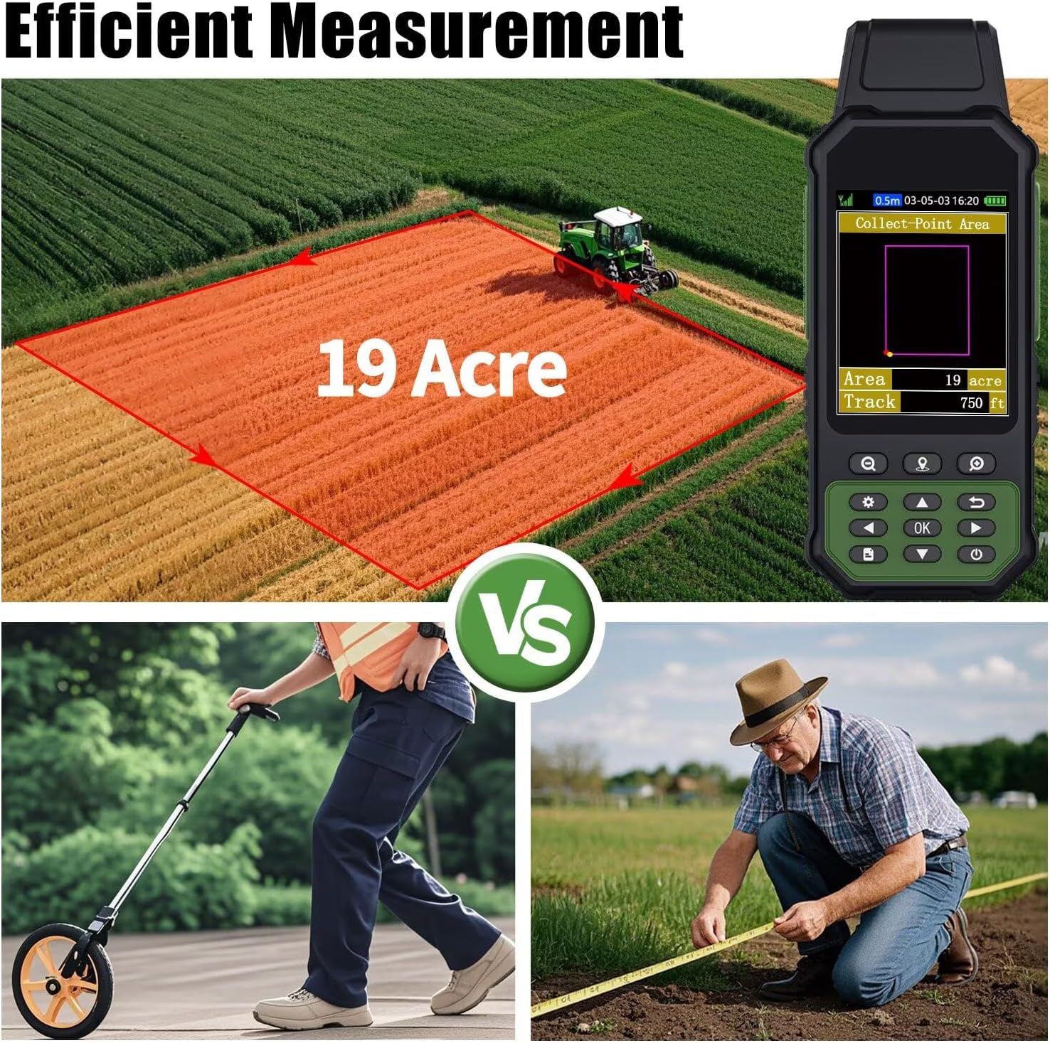
– **High Precision Technology:** The ZL190 is equipped with advanced GPS technology to deliver centimeter-level accuracy, ensuring precise measurements for your surveying projects.
– **Versatile Terrain Adaptability:** Designed for use in both mountainous slopes and flat fields, this GPS device adapts seamlessly to various landscapes, providing consistent and reliable data.
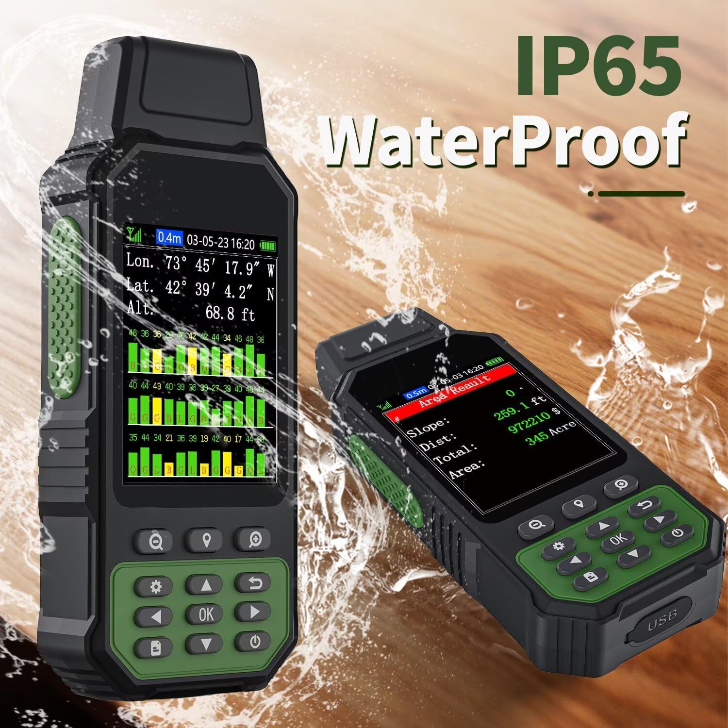
– **Robust and Durable Design:** Built to withstand harsh outdoor conditions, the ZL190 features a rugged construction that is both water and dust resistant, making it ideal for challenging environments.
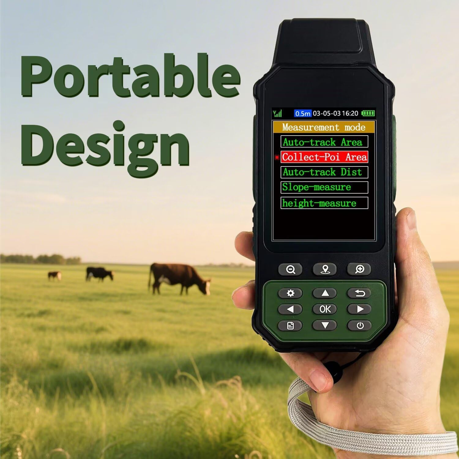
– **User-Friendly Interface:** The intuitive interface allows for easy operation, enabling you to quickly set up and start your surveying tasks without any hassle.
– **Long Battery Life:** With an extended battery life, the ZL190 ensures you can complete your fieldwork without interruptions, even in remote locations.
– **Compact and Portable:** Its lightweight and ergonomic design make it easy to carry and use in the field, enhancing your mobility during surveying activities.
**Applications:**
– **Surveying and Mapping:** Perfect for professionals in land surveying, mapping, and GIS applications.
– **Construction Projects:** Ideal for site planning and layout in construction environments.
– **Agricultural Land Management:** Use it for precision farming and land assessment.
– **Environmental Studies:** Conduct accurate environmental assessments and data collection.
**Package Includes:**
– ZL190 Handheld GPS Device
– Protective Carrying Case
– Rechargeable Battery Pack
– USB Charging Cable
– Quick Start Guide
**Why Choose ZL190?**
With the ZL190 Handheld GPS, you’re investing in a tool that offers exceptional precision, reliability, and ease of use, tailored for professionals who work in challenging terrains. Trust in its performance to elevate the accuracy of your projects and streamline your workflow.
—
Equip yourself with the ZL190 Handheld GPS for surveying and experience the difference in precision and efficiency today!
Related products
-

-
Sale!

LandAirSea 54 GPS Tracker – Made in the USA from Domestic & Imported Parts. Long Battery, Magnetic, Waterproof, Global Tracking. Subscription Required
Original price was: €29.95.€14.95Current price is: €14.95.